



COL - MT Broad band
Site information
ID: COL
Name: Colledellanoce (AN)
Latitude (N): 43°23'38.00"
Longitude (E): 12°49'41.00"
Altitude(m.a.m.s.l.): 448
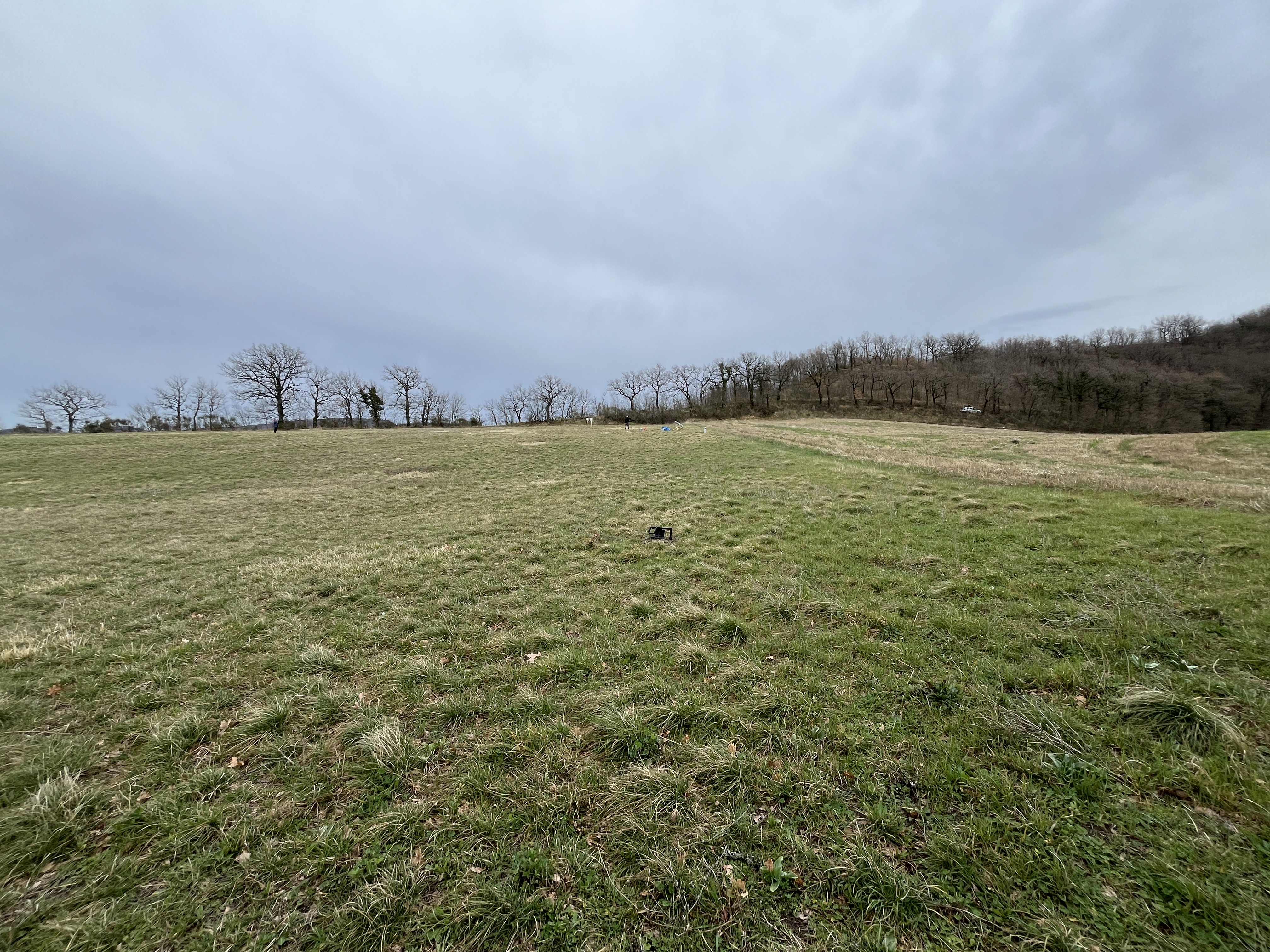
East - West view
Campaign information
Campaign type: MT Broad band
Start: 06/03/2024
End: 18/03/2024
Data Quality: TBD
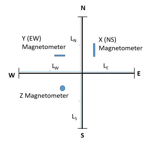
Orientation : orthogonal
LN (m)= 40
LS (m)= 40
LE (m)= 31
LW (m)= 49
Campaign results
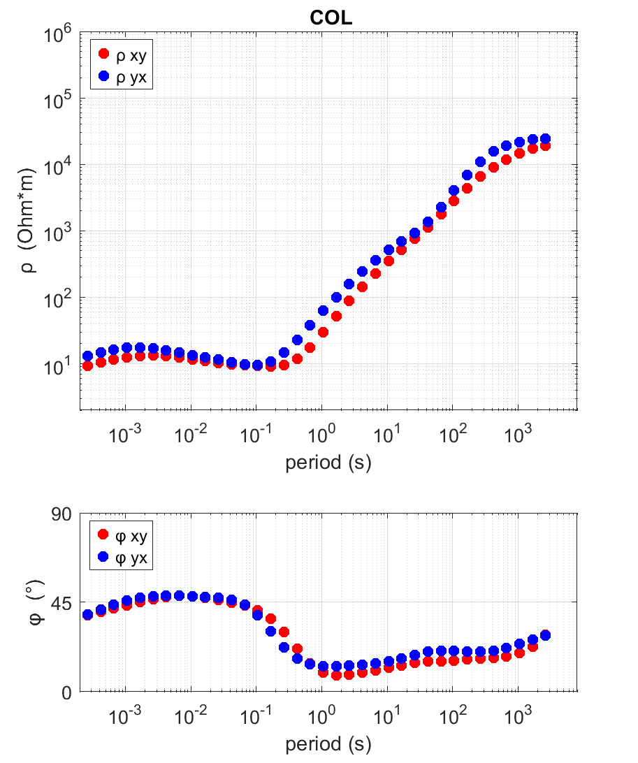
Results of the Broad-Band MT Survey at COLDELLANOCE (COL)
The graph displays the results of data processing from the measurement campaign at the station. In the upper panel, apparent resistivity is shown on a double logarithmic scale as a function of period (expressed in seconds), with the ρXY component in red and the ρYX component in blue. In the lower panel, the associated phase is plotted using the same scale. The curve trends provide insights into the subsurface electrical structure, highlighting conductivity variations related to the area's geology.
Data Policy
Not available yet
COL - MT Long term
Site information
ID: COL
Name: Colledellanoce (AN)
Latitude (N): 43°23'38.00"
Longitude (E): 12°49'41.00"
Altitude(m.a.m.s.l.): 448
East - West view
Campaign information
Campaign type: MT - Long term
Start: 11/02/2026
End: 30/03/2026
Data Quality: TBD
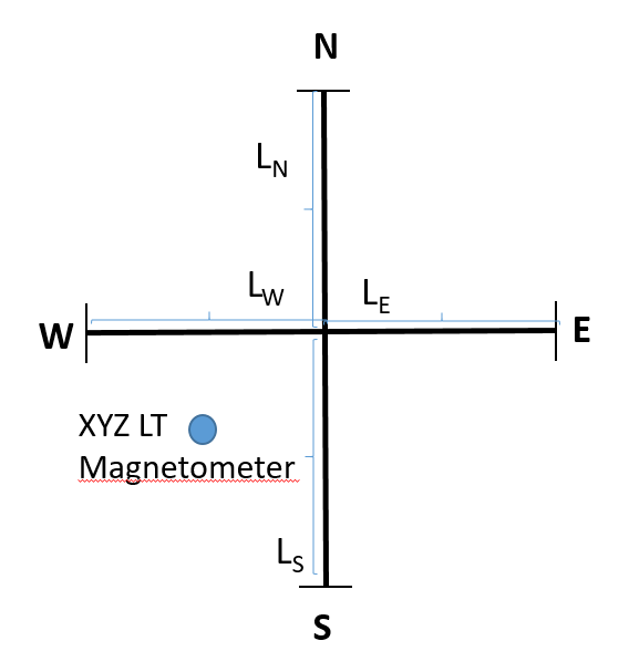
Orientation : orthogonal
LN (m)= 40
LS (m)= 40
LE (m)= 40
LW (m)= 40
Campaign results
Not available yet
Data Policy
Not available yet