
Reconstruction of the elevation (meters above the sea level in 1905 – first leveling by Istituto Geografico Militare) through time within the Campi Flegrei caldera, obtained integrating geological, historical and archaeological data.
Scheme of the Volcanic and Seismic source Modelling (VSM) tool used to perform geodetic data inversions. The input of VSM consists of at least one geodetic dataset. The forward model is one or more analytical source(s). One of the two available inversion algorithms is selected. After data inversion is completed, several products are generated as output.
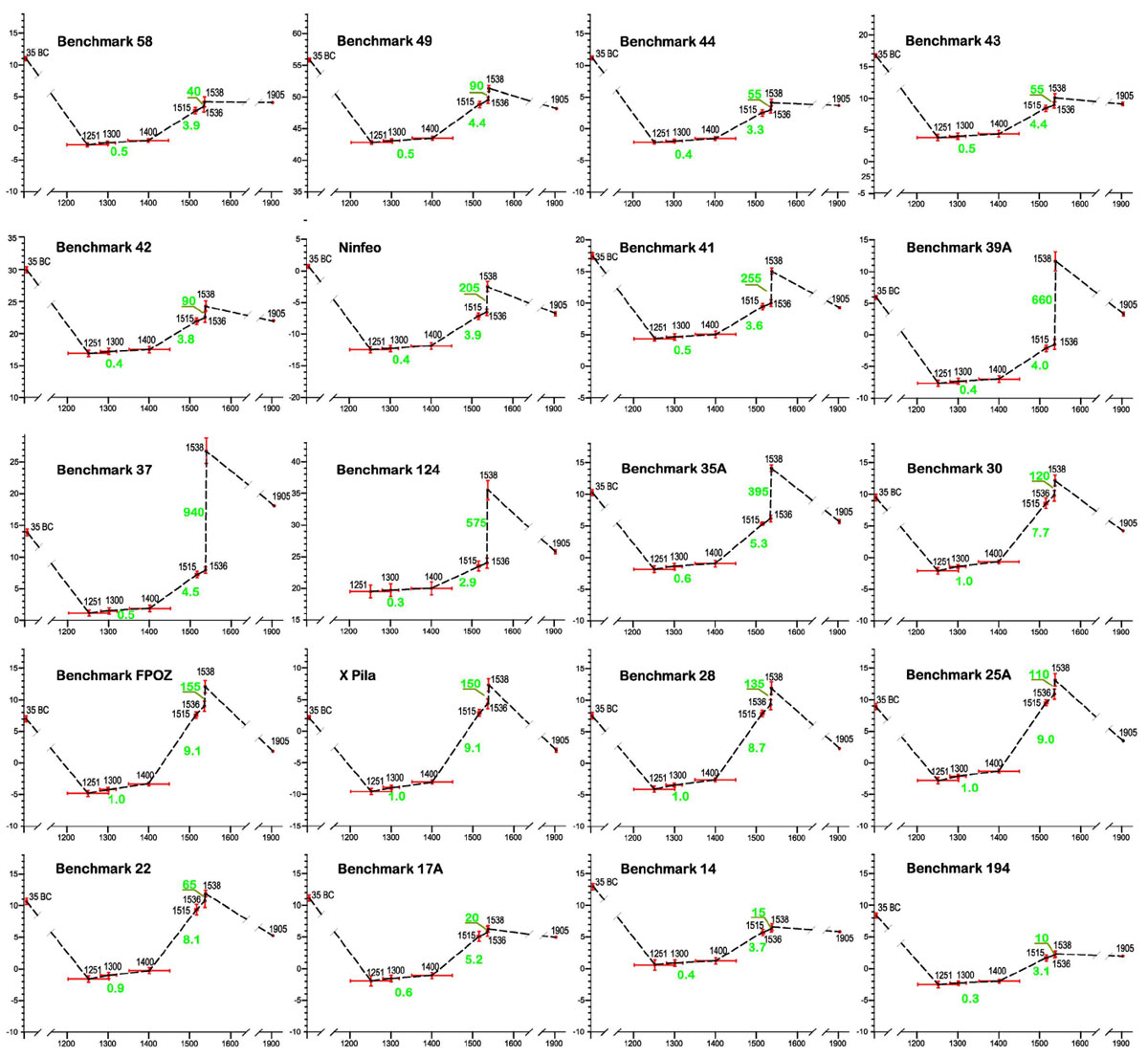
Reconstruction of elevation changes since 35 BP
The Reconstruction of the ground movements is performed with an unprecedented integrated analysis of geomorphological, sedimentological, paleontological, archaeological and historical data. This procedure allowed a detailed and quantitative reconstruction of the evolution of the ground displacements since 35 BP, evidencing the deformations related to the 1538 Mt. Nuovo eruption along the coastline of the Pozzuoli Bay.
Geodetic Data Analysis
InSAR analysis applied to the long dataset of ERS, Envisat and Cosmo-SkyMed images acquired from 1992 to 2020 was performed by multi-temporal Interferometric Point Target Analysis (IPTA) approach. Such approach allows to select the interferograms to be used to estimate both ground deformation rate and displacement time series by maxima baseline criteria. The chosen interferometric pairs are then estimated, filtered by Goldstein filtering and unwrapped by minimum cost flow algorithm. Hence, we select the InSAR point targets by accepting the points with temporal coherence value equal or greater than 0.4 and the final solution is found by Singular Value Decomposition analysis.
The outcomes show a deflation phase of Campi Flegrei imaged by ERS data from 1992 to 2002, followed by a first slow inflation phase until 2010 detected by Envisat data and then the fast inflation with uplift values up to 10 cm/yr started in 2011 as detected by Cosmo-SkyMed data.
Geodetic data modelling
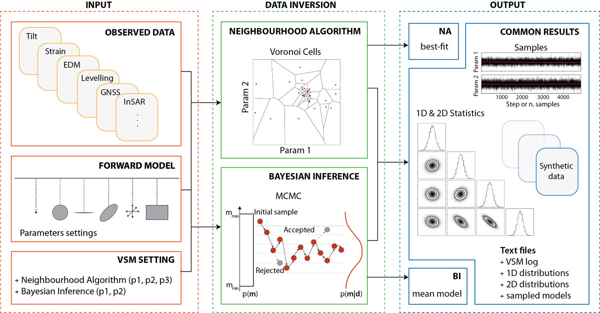
The large amount of geodetic data collected is analyzed by an inverse modelling scheme, to retrieve the active deformation sources at Campi Flegrei. Data inversion is performed using the Volcanic and Seismic source Modelling (VSM) tool. VSM is an open source Python tool that accepts input data from most of the geodetic techniques (InSAR, GPS, levelling, EDM, tilt and strain data), alone or in combination. The VSM tool allows the user to choose one or more geometrical source as forward model among sphere, spheroid, ellipsoid,fault, and sill. Two inversion tools are available, one is a global optimization algorithm based on the Voronoi cells and the second follows a probabilistic approach to parameters estimation based on the Bayes theorem. VSM can be executed as a Python script, in a Jupyter Notebook environment or by its Graphical User Interface. VSM, developed at INGV, supports all the activities related to geodetic data inverse modelling in the project.