
Promud WP2 has as its main objective remote sensing surveys aimed at carrying out morphological studies of the areas affected by phenomena linked to mud volcanoes and, where possible, to observe the presence of temporal variations possibly linked to the phenomena of interest.
The study areas in Emilia Romagna are generally aligned in a border band between the lower Apennines and the plain.
In recent years, numerous inspections have been carried out and the surveys began with the observation of the Salse di Nirano and the Salse del Dragone, in the provinces of Modena and Bologna.
The Salse di Nirano were initially detected using terrestrial laser scanning technology, occupying station points in the corona surrounding the extrusion area, as shown in the figure. The advantage of a technology of this type, designed for long-range surveys, is given by the great stability of the results and the excellent resolution but it suffers from logistical constraints due to the need of good incident angle an positioning in areas where vegetative cover is minimal (figure 1).
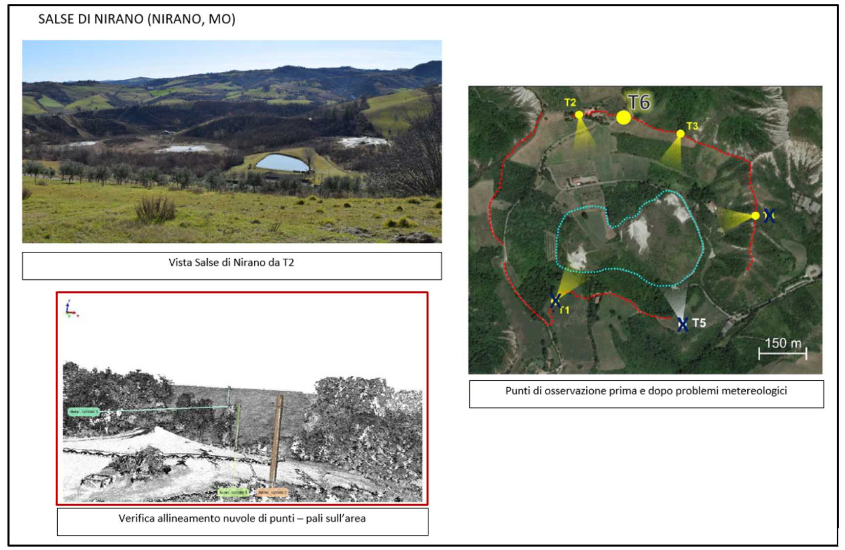 Figure 1. Salse di Nirano from a TLS station point; the pattern of TLS measurements from a set of station points; a check of alignment of the scans with anthropic targets present in the area.
Between 2020 and 2024, the scans of the Salse di Nirano were compared and an area showing variations of a few centimeters was identified. This result suggests that the phenomena that generate the mud extrusions could have a very superficial matrix and the identified area appears to be located above the major subsoil discontinuities obtained with geophysical techniques such as geoelectric, seismic and gravimetry.
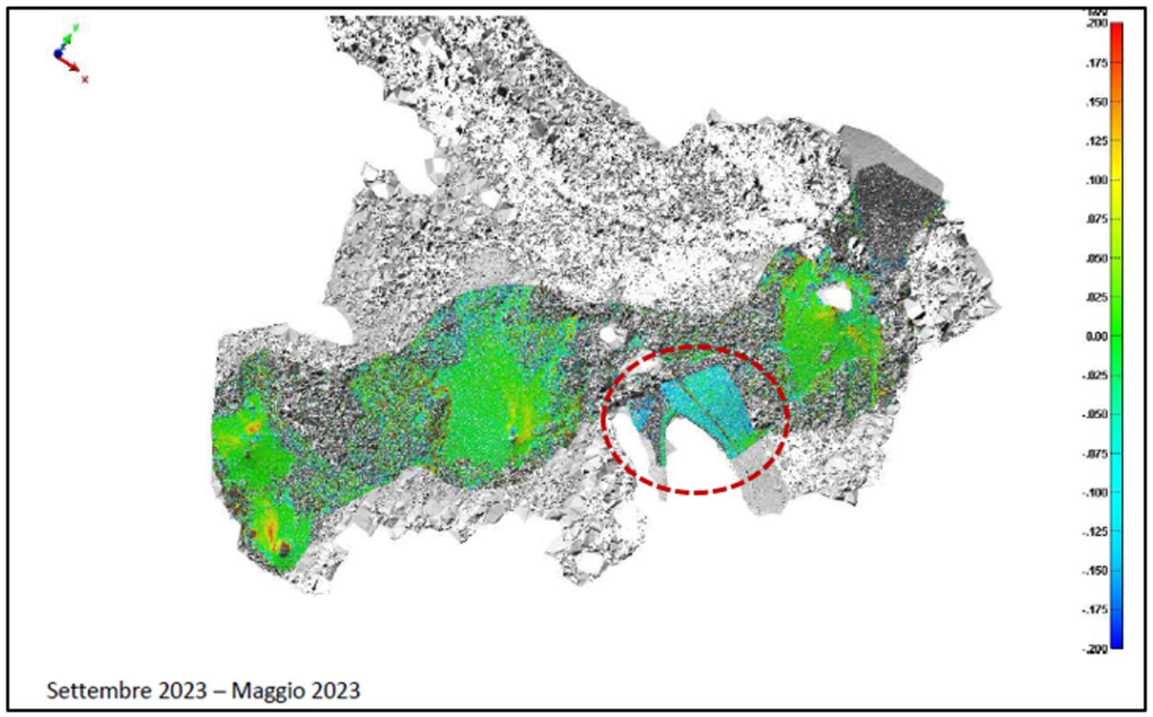 Figure 2. Area identified with variations of several centimeters with a raising and lowering effect noted in the various comparisons. Note that other areas are covered by a patch of grass and become transparent to analysis.
In spring 2024, as foreseen in the project roadmap, a good quality UAS (drone) instrumentation was acquired which mounts a full-frame camera to carry out detailed photogrammetric surveys on the entire sauce area in order to have models multi-temporal in real scale (as in the TLS case) but guaranteeing total coverage without being too affected by the presence of bulky vegetation. The acquisition was necessary verifying, in the first year of the project, that the drones (mavic) already available at IngvBo did not have the necessary requirements, being equipped with a compact camera sensitive to the systematic effects being analyzed due to internal calibration of the camera.
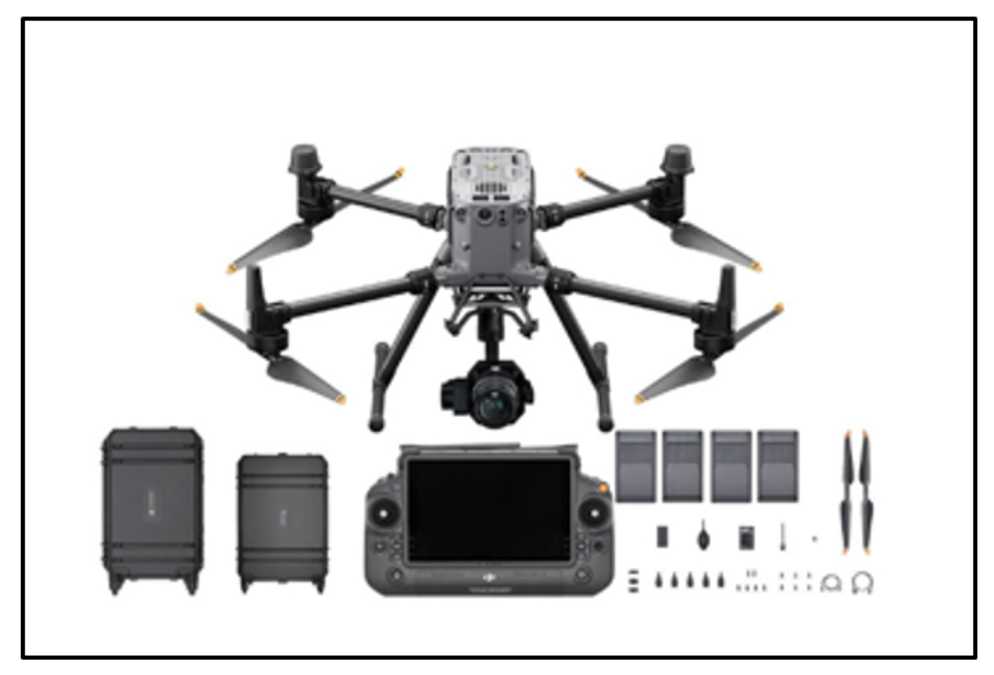 Figure 3. Matrice 350 RTK. Drone equipped with full-frame camera for complete sauce surveys.
The first UAS survey with the Matrice 350 drone and RTK system was carried out in June 2024 in the Salse del Dragone area (Sassuno, BO). A side of the lower Apennines, historically known for extrusive effects, eruptions and mudflows, fully active. The study of the morphology of the area made it possible to highlight the body of the landslide which clearly follows the layout of the slope. Passive seismic studies have identified clay layers of several meters and the accumulation can be seen very clearly today (figure 4).
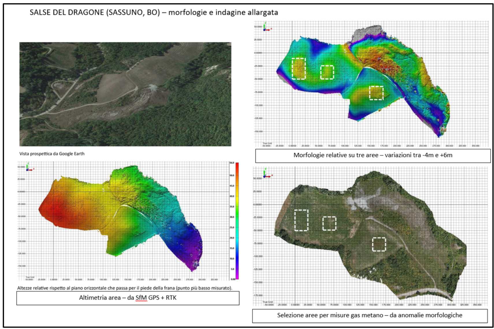 Figure 4. Salse del Dragone measured and analyzed using SfM UAS photogrammetry. The elevations and morphology show the accumulations of the leaked material and, also looking at the surrounding areas, indicate the areas in which to extend the methane gas detection observations. Here are the ideas for the next missions.
Having today particularly high-performance UAS technology available, missions are also being planned in other areas of the region affected by mud volcanoes (figure 5).
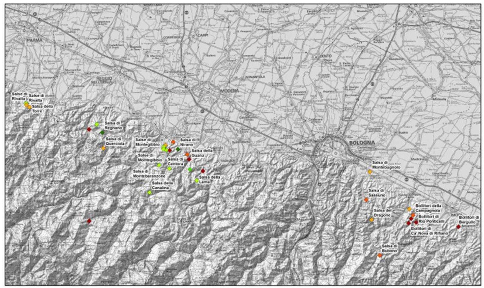 Figure 5. Mud volcanoes as reported by Emilia-Romagna region.