
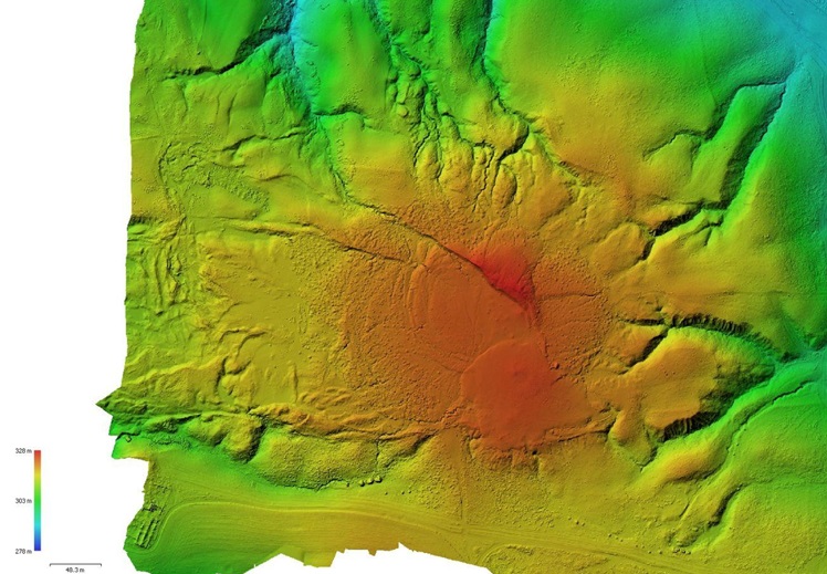
Digital model from aerial photogrammetry of the Maccalube di Aragona site (Agrigento)
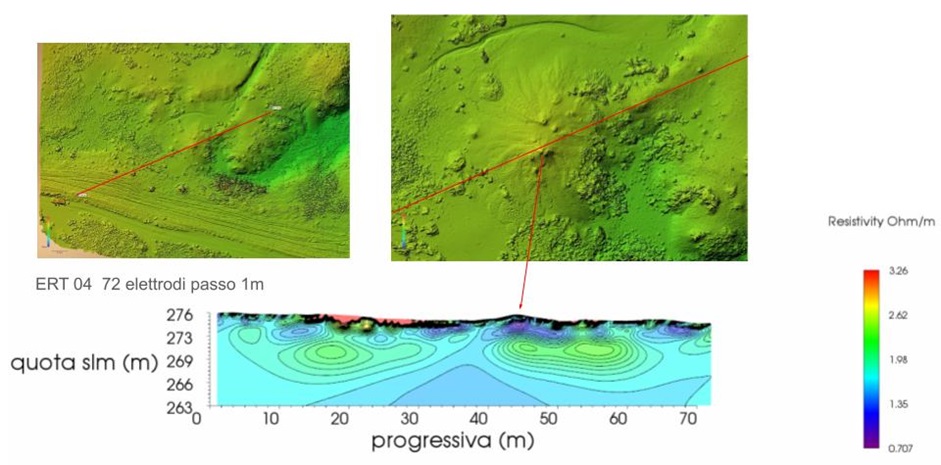
Example of an electrical tomography profile on an active mud cone at the Maccalube di Aragona site
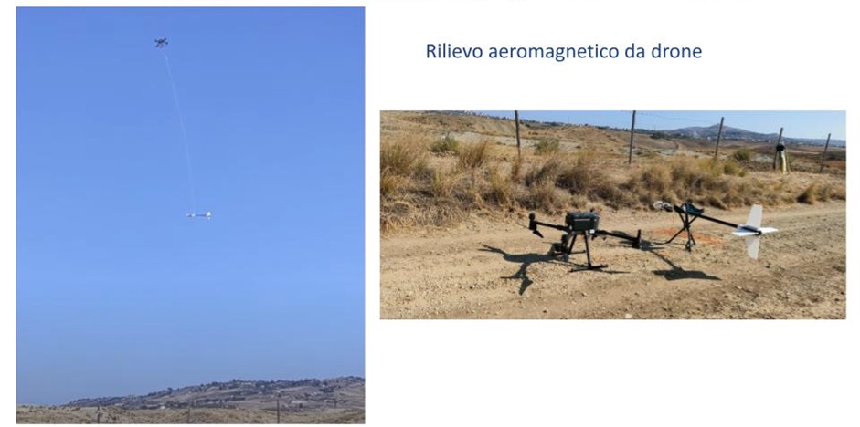
Drone-based aeromagnetic acquisition system (DJI Matrice 300 RTK) suspended by a 10-meter cable
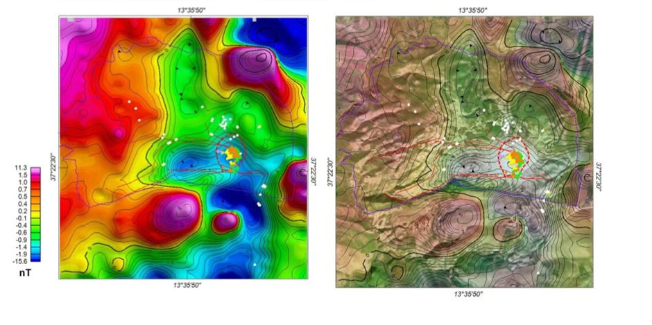
Magnetic anomaly of the Maccalube di Aragona site, obtained from a flight at 50 meters above ground level. Overlaid are previously mapped faults and emission points. Left image: magnetic anomaly in color scale. Right image: magnetic anomaly overlaid on a digital terrain model
The objective of the research group operating WP4 is to investigate the mud volcano areas of Maccalube di Aragona (Agrigento) and Salse di Nirano (Modena) through geophysical surveys, including drone-based aerial magnetometry and electrical tomography for the Maccalube area. Geophysical surveys have proven to be a valuable tool for mapping subsurface crustal structures that do not outcrop at the surface.
Using an aerial platform developed by the research group, consisting of an optically pumped scalar magnetometric system housed within an aerodynamic casing and suspended from a remote-controlled drone by a 10-meter cable, it was possible to conduct flights to acquire magnetic anomaly data for the study areas. Additionally, digital terrain models of the two study sites were created using digital aerial photogrammetry. A series of electrical tomography profiles were conducted at Maccalube di Aragona.
The aeromagnetic surveys were carried out at an altitude of approximately 50 meters above the ground surface, with profiles spaced about 30 to 100 meters apart